Vanilla World Generator
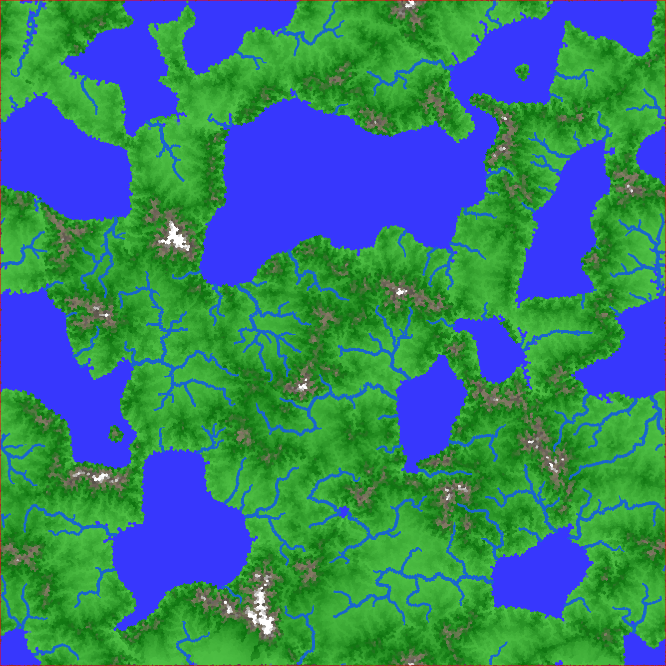
Pre-generated world with realistic rivers and mountain ranges:
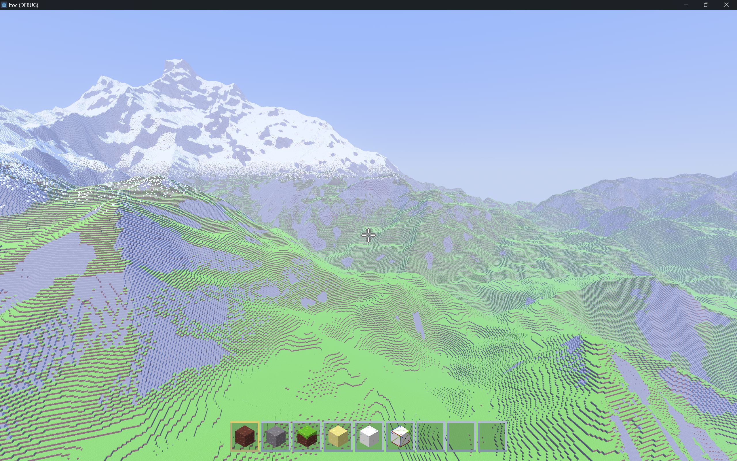
Real-time world generation after pre-generation:
Currently, ITOC vanilla world has a default pre-generated size of 100km x 100km.
The entire pre-generation time is less than 4 seconds. (i5-12500h)
The rivers and mountains are generated by solving the stream power equation, see G. Cordonnier et al., “Large Scale Terrain Generation from Tectonic Uplift and Fluvial Erosion”.
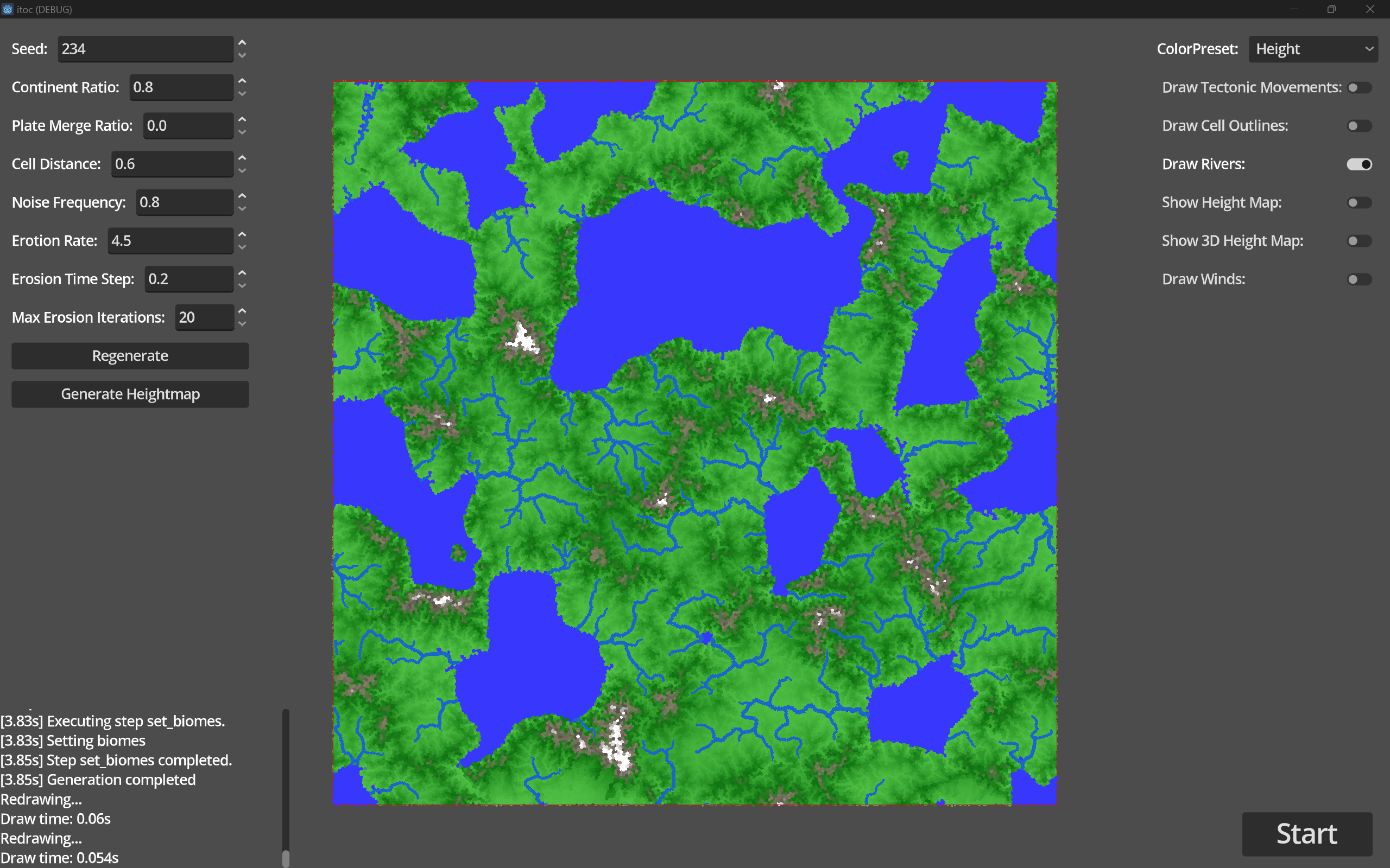
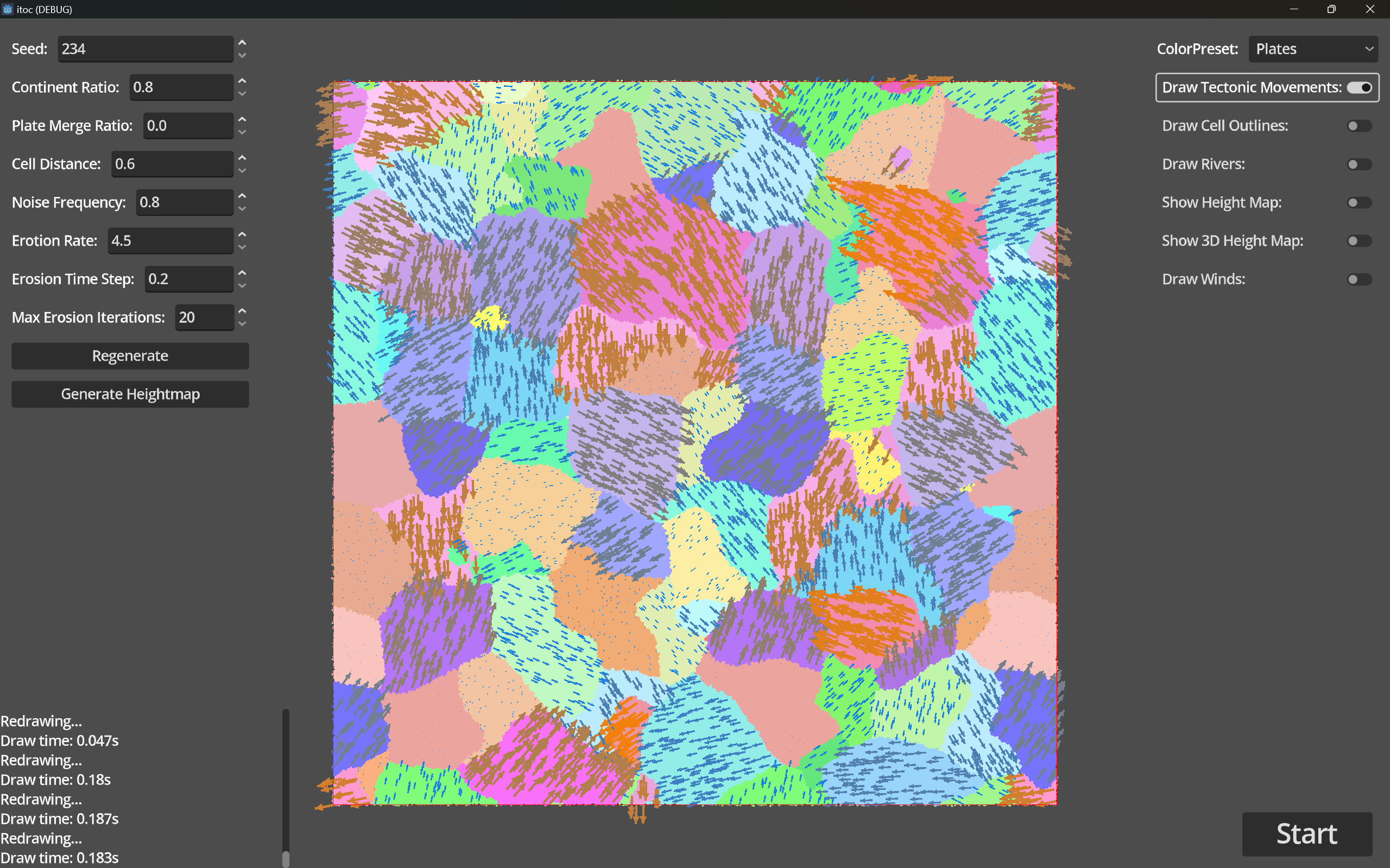
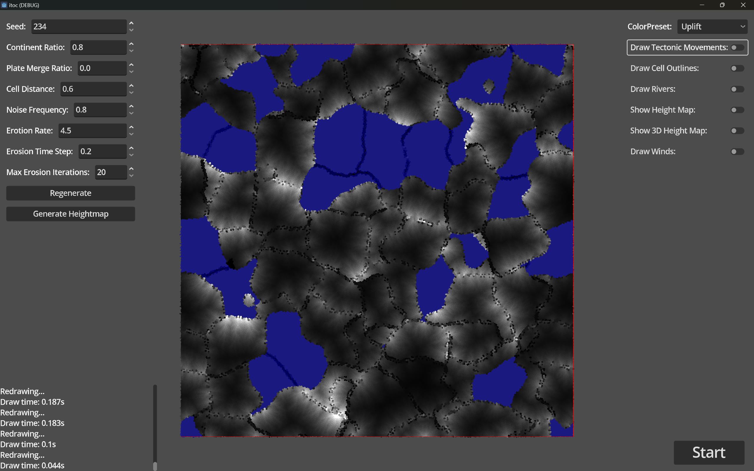
The uplift map is generated from plate tectonics:
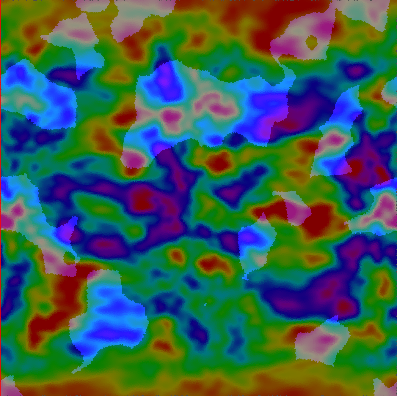
The uplift map which controls the river generation and height map generation:
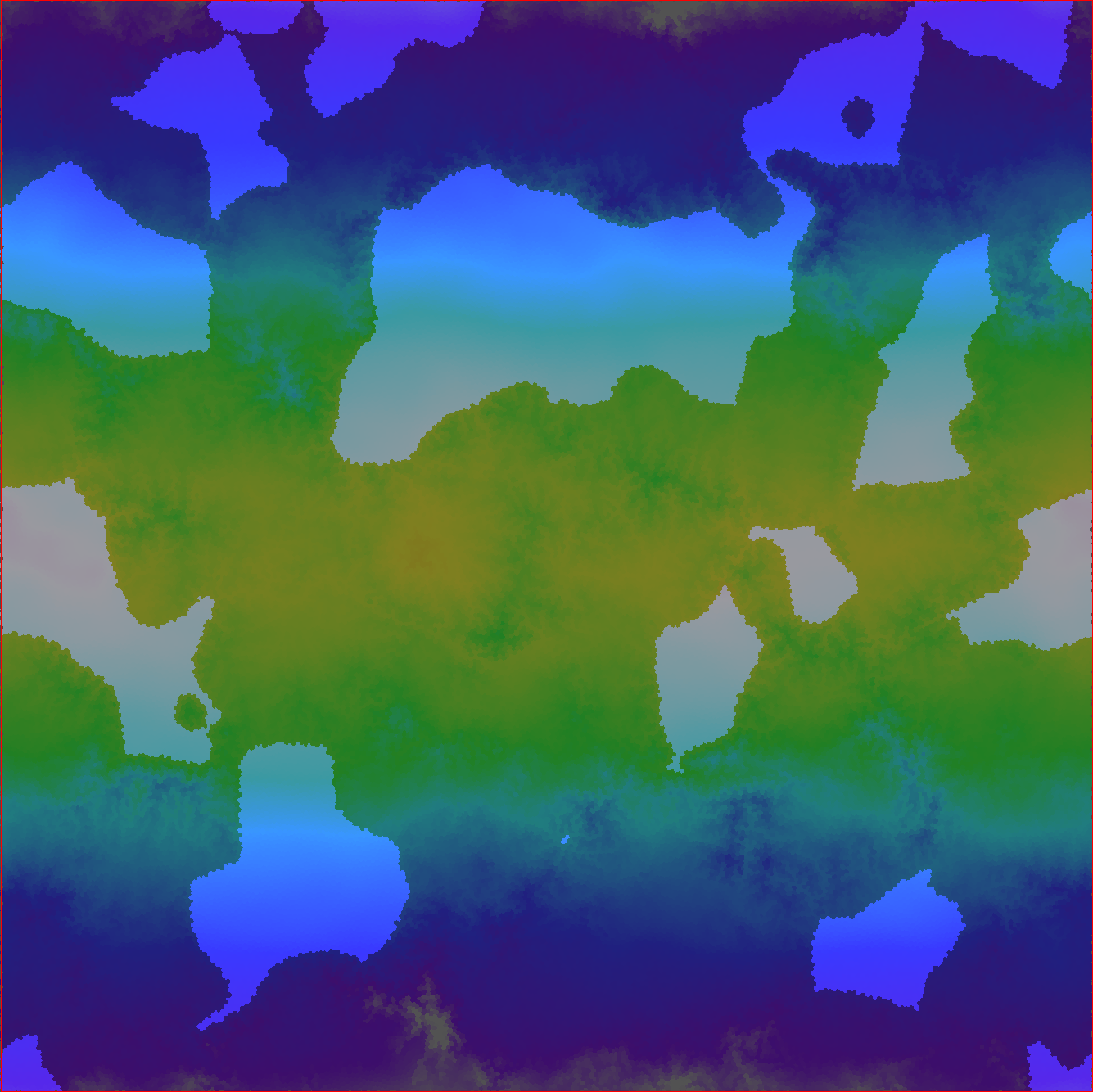
Noise (Pattern tree) based precipitation and temperature map:
References
- Polygonal Map Generation for Games
- Making maps with noise functions
- Noise Functions and Map Generation
- Friday Facts #390 - Noise expressions 2.0 | Factorio
- Fantasy Maps for fun and glory – javascript, mapmaking, procedural generation
- making realistic terrain : r/proceduralgeneration
- Game terrain generation is pretty simple, actually - YouTube
- Better Mountain Generators That Aren't Perlin Noise or Erosion - YouTube
- This terrain generator is better than yours (Daydream pt. 8) - YouTube
- Procedural Terrain Generation - YouTube
Tectonic Plates
Minecraft
- World generation – Minecraft Wiki
- How Minecraft ACTUALLY Works 💎⛏️ - YouTube
- Reinventing Minecraft world generation by Henrik Kniberg - YouTube
- Minecraft terrain generation in a nutshell - YouTube
- How Does This World Gen Have Sloped Rivers and Waterfalls? - YouTube
- How Does Minecraft Generate Worlds? - YouTube
Wave Function Collapse
- mxgmn/WaveFunctionCollapse: Bitmap & tilemap generation from a single example with the help of ideas from quantum mechanics
- Superpositions, Sudoku, the Wave Function Collapse algorithm. - YouTube
Diterministic
- Deterministic Procedural Wave Function Collapse - Game Development Stack Exchange
- Infinite Modifying in Blocks – BorisTheBrave.Com
- GIF
Papers
- J. Olsen, “Realtime Procedural Terrain Generation,” Oct. 2004.
- H. Hnaidi, E. Guérin, S. Akkouche, A. Peytavie, and E. Galin, “Feature based terrain generation using diffusion equation,” Computer Graphics Forum, vol. 29, no. 7, pp. 2179–2186, 2010, doi: 10.1111/j.1467-8659.2010.01806.x.
- J.-D. Génevaux, É. Galin, E. Guérin, A. Peytavie, and B. Benes, “Terrain generation using procedural models based on hydrology,” ACM Trans. Graph., vol. 32, no. 4, p. 143:1-143:13, Jul. 2013, doi: 10.1145/2461912.2461996.
- J. Génevaux et al., “Terrain Modelling from Feature Primitives,” Computer Graphics Forum, vol. 34, no. 6, pp. 198–210, Sep. 2015, doi: 10.1111/cgf.12530.
- G. Cordonnier et al., “Large Scale Terrain Generation from Tectonic Uplift and Fluvial Erosion,” Computer Graphics Forum, vol. 35, no. 2, pp. 165–175, May 2016, doi: 10.1111/cgf.12820.
- E. Guérin, J. Digne, E. Galin, and A. Peytavie, “Sparse representation of terrains for procedural modeling,” Computer Graphics Forum, vol. 35, no. 2, pp. 177–187, May 2016, doi: 10.1111/cgf.12821.
- G. Cordonnier et al., “Authoring landscapes by combining ecosystem and terrain erosion simulation,” ACM Trans. Graph., vol. 36, no. 4, p. 134:1-134:12, Jul. 2017, doi: 10.1145/3072959.3073667.
- É. Guérin et al., “Interactive example-based terrain authoring with conditional generative adversarial networks,” ACM Trans. Graph., vol. 36, no. 6, pp. 1–13, Dec. 2017, doi: 10.1145/3130800.3130804.
- G. Cordonnier, M.-P. Cani, B. Benes, J. Braun, and E. Galin, “Sculpting Mountains: Interactive Terrain Modeling Based on Subsurface Geology,” IEEE Trans. Visual. Comput. Graphics, vol. 24, no. 5, pp. 1756–1769, May 2018, doi: 10.1109/TVCG.2017.2689022.
- E. Galin et al., “A Review of Digital Terrain Modeling,” Computer Graphics Forum, vol. 38, no. 2, pp. 553–577, 2019, doi: 10.1111/cgf.13657.
- C. Grenier, É. Guérin, É. Galin, and B. Sauvage, “Real‐time Terrain Enhancement with Controlled Procedural Patterns,” Computer Graphics Forum, vol. 43, no. 1, p. e14992, Feb. 2024, doi: 10.1111/cgf.14992.
- P. Tzathas, B. Gailleton, P. Steer, and G. Cordonnier, “Physically‐based analytical erosion for fast terrain generation,” Computer Graphics Forum, vol. 43, no. 2, p. e15033, May 2024, doi: 10.1111/cgf.15033.
See also: